SOUTHERN UTAH

SOUTHERN UTAH

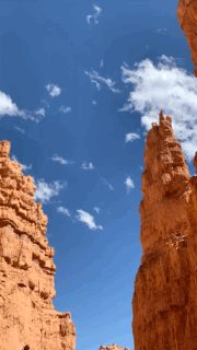
BRYCE CANYON - Hoodoos on Navajo Loop Trail - Photo by Erin Shaw
southern utah
ZION . BRYCE CANYON . GRAND ESCALANTE
CAPITOL REEF . ARCHES . MONUMENT VALLEy
honorable mentions . gear . playlist
I’ve been having a difficult time describing just how intensely epic and mystifying Southern Utah is. There is simply nothing else like it I have seen, and frankly, I feel it has been underrepresented as it is clearly one of the most magnificent destinations on the globe. With such a variety of geological wonders within such close proximity to one another, it is a challenge to take in all the beauty in just one trip. Whether you have visited a hundred times or never before, do yourself a favor and plan a camping-road-trip through Utah as soon as possible.
The Anasazi Native Americans called Southern Utah home and their polytheistic beliefs are represented in the four Elemental Gods: Earth, Sun, Sky, and Water. All four of these deities can be seen boldly displaying their mighty powers throughout this land. The Anasazi, which translates to “ancient outsiders”, are a native society infamous for “disappearing without a trace”. It is hard to not correlate their mysterious existence with their other-worldly, geological surroundings. Truly, visiting Southern Utah is your best opportunity at experiencing life on an alien planet.
THINGS TO KNOW
Have yourself a good, off-roading vehicle for this adventure if you want to make it worth-while
Best time of year to do this trip would be late Spring or Early-Mid Fall
Expect your plans to change, and have the resources to be able to adapt to whatever awesomeness presents itself to you
The best spots in So. Utah lack cell service, FYI
Higher the altitude you are at = the colder it will get at night
Consider purchasing a National Park Annual Pass - America The Beautiful Pass since Utah is jam-packed with so many national parks in one place, at $80, the pass pays for itself with one trip!
The Secret Spots below are listed in road trip order. See map below!
The above road map begins and ends in Los Angeles, CA but of course it can be customized from wherever you are beginning your journey. There were many stops and secrets along the way - some planned and some not. Our journey was done in 10 days with a couple Arizona destinations at the end. This post will only cover Utah details but stay tuned for many Arizona posts to come!
THE SECRET SPOTS
ZION REGION


where to stay
ZION WRIGHT FAMILY RANCH
$29 a night
Bill Wright, the patriarch cowboy of the 6-generation-run-ranch, said it best while on our guided horseback ride, “Well, you sure ruined the rest of your trip by staying here first.” Our trip was far from ruined, but it was absolutely the most breathtaking campsite we stayed at ,and nothing could quite compare to it.
This1,240 acre ranch is beyond spacious and sits atop a butte just outside of the national park. You actually have to drive through the outskirts of Zion Park to access the ranch, up a few miles of rough dirt road, naturally. While the park campsite (Watchman Campground) is absolutely beautiful and it provides all the necessary facilities, it is where everybody stays, and the Zion Wright Family ranch, alternatively, offers a private and secluded, off-the-grid experience with10-minute park access, quiet nights, and dramatic star views.
Stupidly epic views and spaced-out campsites with rock fire pits
Porta-pottys dispersed here and there but mostly Leave No Trace toilet situation here. Check out my How To Poop In the Woods post if you are confused by what that means
Be sure to do the Sunset Horseback Ride around the property - all experience levels welcomed
No tables or potable water
Very limited cell service here
Reserve a site but then you get to pick your own on arrival - no “check-in” process. Be sure to follow the directions you receive upon your reservation and not just google maps
Location is sometimes subject to wind, horse gnats (weather and time-of-year-depending), and SO many stars


ADVENTURES
Kanarra Creek Canyon Trail
3.5 miles / Moderate / Out-and-back
$12 permit + reservation needed. Be sure to make the reservation a good month or so before your trip, at least, because they fill-up fast (limit 150 persons per day)
Gorgeous sights, river-slot-canyon-hiking, like The Narrows, but without all the hullabaloo and crowds
Canyon/river ladders and Indiana-Jones-style adventurin’


ZION NATIONAL PARK
$20 Rental Cost
Only really possible to do during an excruciatingly brief window of May through July, while water levels are high, but not too high.
2-mile float and about a 2-ish hour ride dependent on river flow
Not quite a “lazy” river float as the river is shallow and rocky, requiring one to get in and out of their tube frequently to avoid rocks. Easy to great time on this river trail but this activity is may not recommended for everyone.
Close-toed river shoes required


16 miles total /Moderate / Out-and-back
Most of The Narrows is located in Zion National Park, but the first section (if you hike from the top-down) begins on private property just northeast of the park.
The Narrows River Hike within Zion National Park is indeed breathtaking and worth the adventure. No one loves river hikes through narrow slot canyons of epic beauty more than I do, truly, just know that this is where eeeeverybody and their kids are gonna be. As I write this (Sept. 2020), a fungal and toxic bacteria is now spreading rampant through The Virgin River that runs throughout Zion and The Narrows, known to be extremely dangerous. Our over-trafficing of such a precious area has literally befouled ‘The Virgin’. Do this hike someday, but just be sure to pick the right day and time, friends.
OTHER HIKING
Upper Emerald Pool Hike / 3.2 miles / Easy
Angel’s Landing Hike / 5 miles / Hard
The Subways Trail / 9.1 miles / Hard / Permit Required
Renting a bike, or bringing your own, and riding it through the park is a really fun and beautiful way to see this magnificent park and to access the many spots that limited parking and overcrowding can make difficult.
Riding along the bike trail also allows you to waive the park entrance fee and stop and the many swimming holes along the trail


DRIVE THROUGH ZION
BE SURE to drive through the whole park at some point, ideally on your way to Bryce Canyon. One of the most beautiful drives ever. Be sure to also play some epic music while you do. The playlist below would work…
BRYCE CANYON REGION


where to stay
NORTH CAMPGROUND
$20 - $30 a night
Within Bryce Canyon National Park at an elevation of 8,000 ft (it’s colder up here)
Try to reserve a spot along the rim of the campsite, close to the hoodoos!
This site has some shade, access to clean restrooms, water, tables, and firepits, and more stars than you could ever imagine. Pets allowed too!
SUNSET CAMPGROUND
$20 - $100 a night
Also within Bryce Canyon National Park at an elevation of 8,000 ft
This beautiful campsite is mere steps away from some of the best Bryce Canyon hikes and hoodoos for epic sunset and sunrise watching .You can not only camp along the rim, you can enjoy a little privacy, too, with a loop layout and lots of vegetation separating the sites.
Restrooms, showers, tables, potable water, and dogs welcomed!
Sites are for RV’s, tents and walk-in’s, so you can expect a full house in the peak season
PANGUITCH LAKE NORTH CAMPGROUND
$11 - $61 a night
Located outside of the park at 8,400 feet elevation
Panguitch Lake offers great fishing for rainbow, brook, cutthroat and brown trout. You can canoe and kayak here too! Mountain biking and hiking trails nearby.
Restrooms, showers, tables, potable water, and dogs welcomed!
adventures
DIXIE NATIONAL FOREST
15.6 miles / Moderate / Loop Trail
When you enter the Dixie National Forest, right before you get to Bryce Canyon Natl Park, you suddenly enter some real-life Thunder Mountain majesty
Great for hiking, mountain biking, and horseback riding
0.7 mile / Easy / Loop trail
Hoodoos and views for days
Do it
Spectacularly beautiful 24.1 mile, out-and-back trail located near Panguitch, Utah that offers amazing views and is good for all skill levels.
Bike rentals available at Outta Here eBikes or bring your own
Heading West from Bryce Canyon area is mostly downhill so either plan for a long uphill slog on the way back or have a ride back to the start


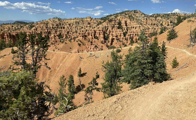
bryce canyon
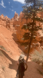
NAVAJO LOOP TRAIL TO PEEKABOO LOOP
5 mile / Moderate / Loop trial
7.8 mile / Moderate / Loop trail


grand ESCALANTE REGION


WHERE TO STAY
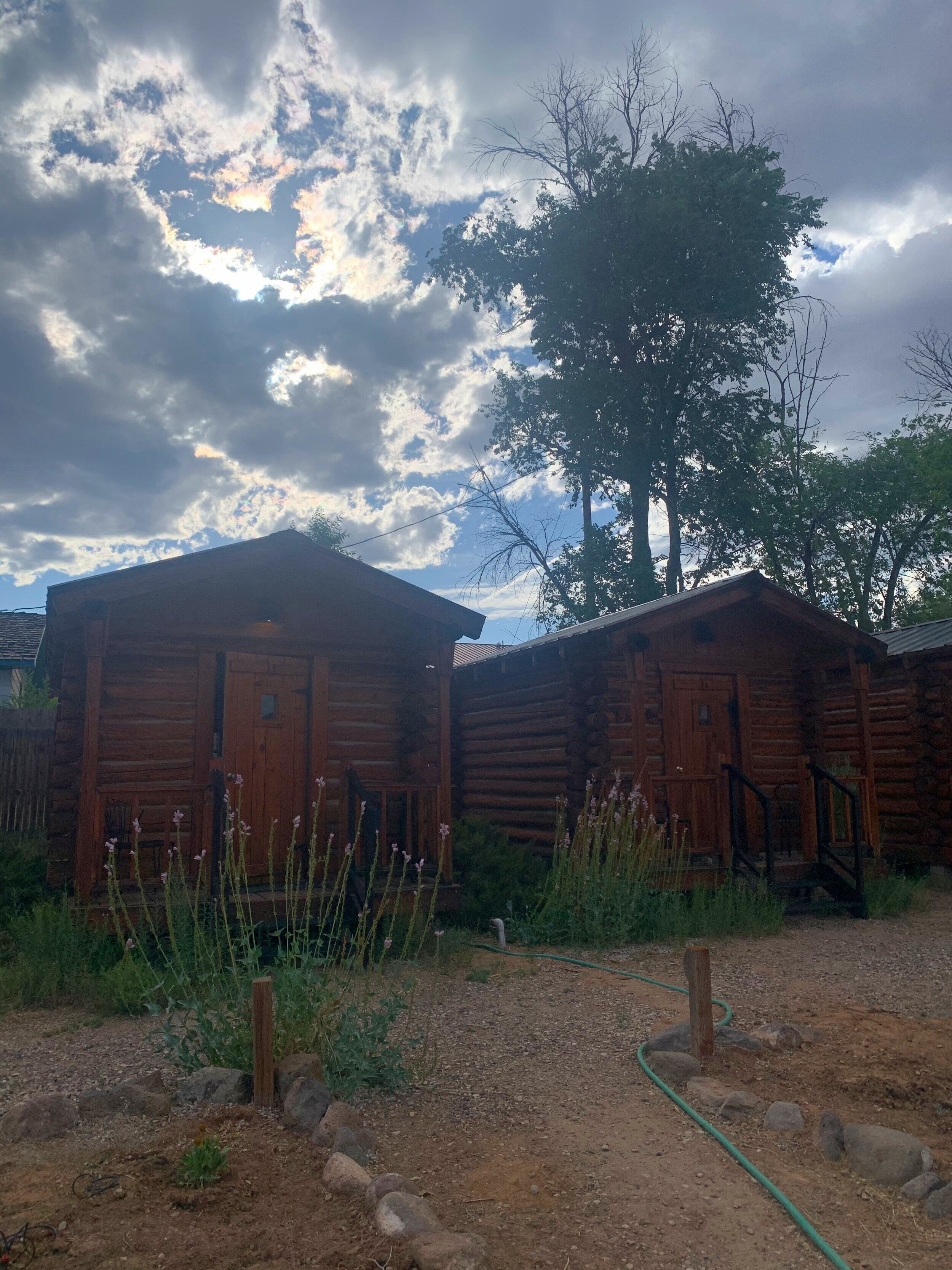
ESCALANTE OUTFITTERS
This place is more of a glamping experience but mid-way through your camping road trip this will be a welcomed break from roughing it, trust me. It has all the amenities you would want and then some.
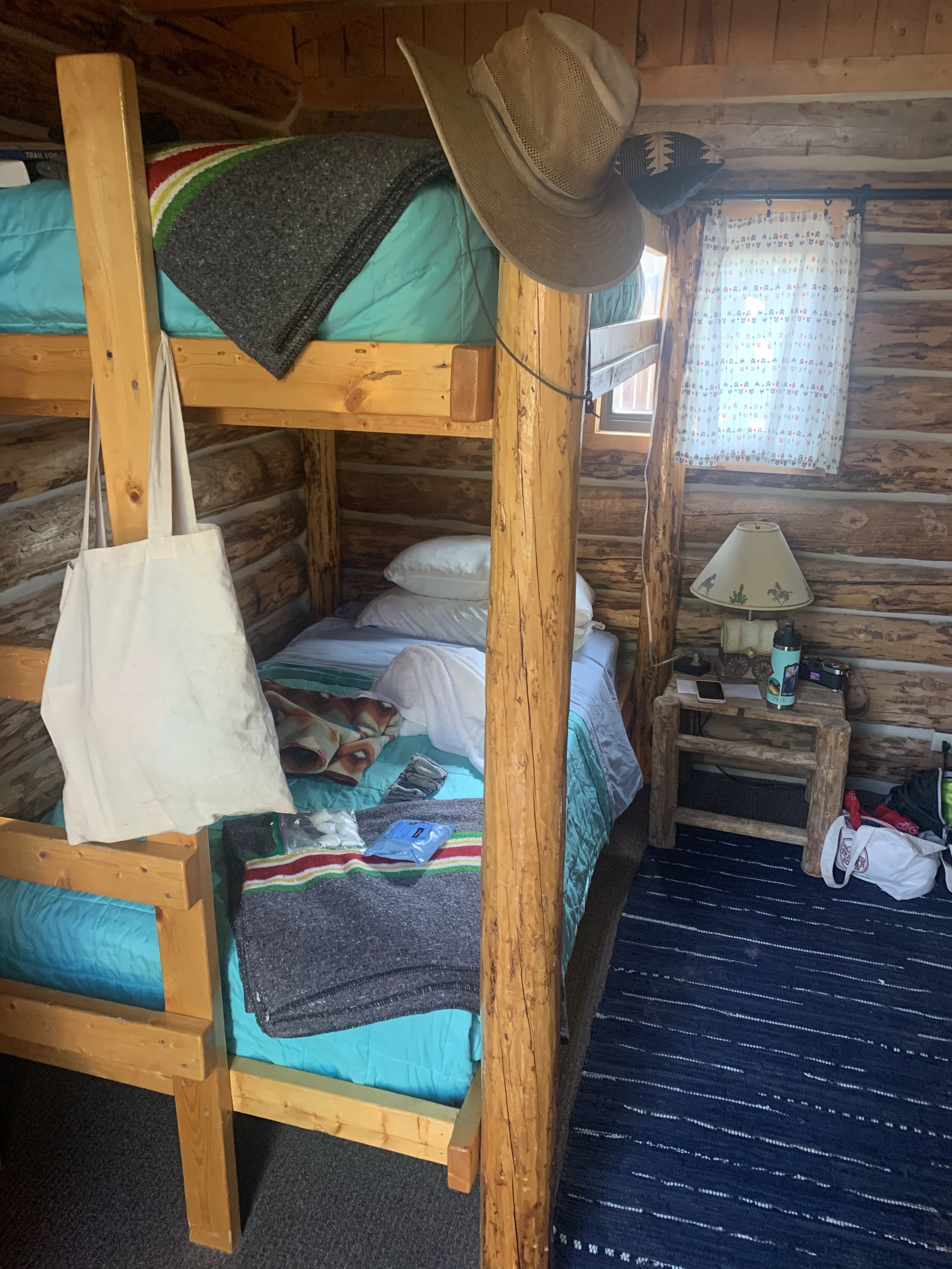
Adorable and simple log cabins with a porch. They come with either a queen-sized bed, 2 twins, or bunk beds.
Pets allowed with at $10 fee
They have a coin-operated laundry facility (bring quarters!) as well as free, hot showers and clean bathrooms = heaven!
Also features a wonderful general store and staff with some of the best pizza I have ever had as well as an exquisite beer selection. Do not miss this spot!
BRYCE VIEW CAMPGROUND
$25 a night and a camping alternative to Escalante Outfitters above
Within the epic Kodachrome State Park
Vault toilet, no hookups, max 4 people, 1 vehicle per site

adventures
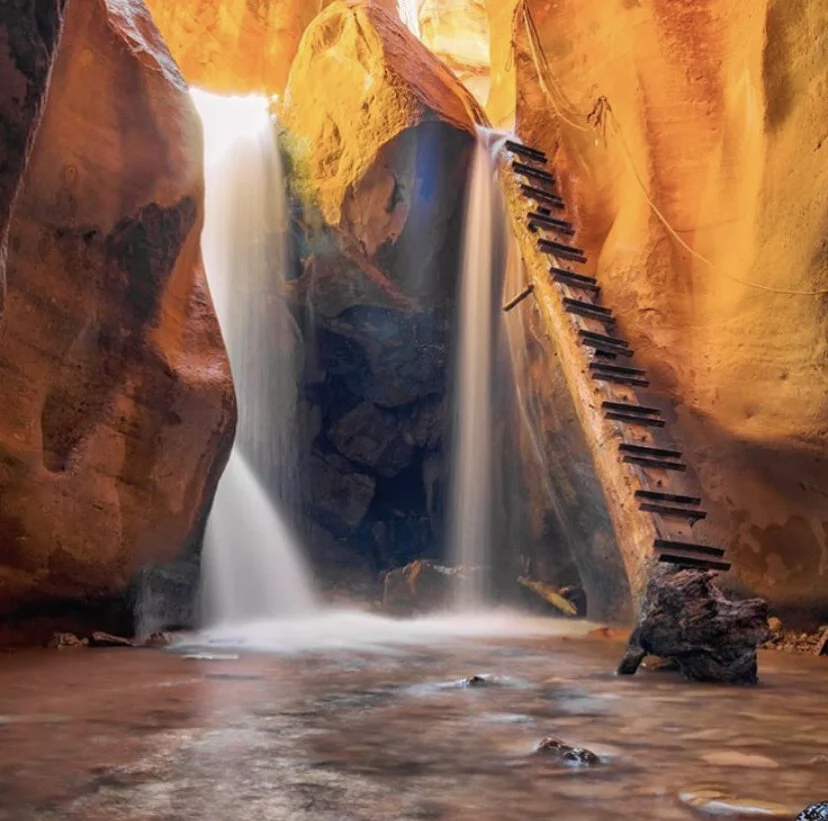
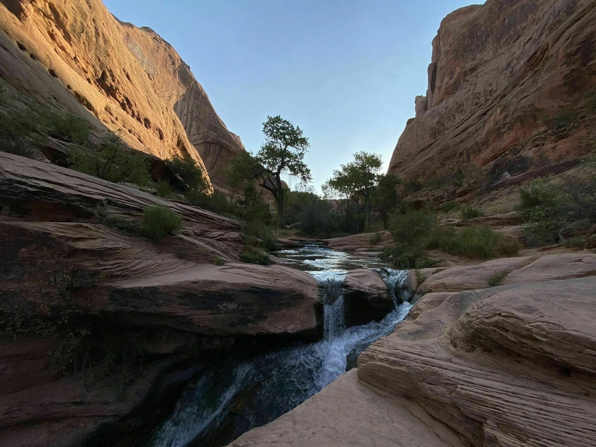
LOWER CALF CREEK FALLS HIKE
6.7 miles / Moderate / Out-and-back
Perhaps the best hike I have ever been on. It is the perfect way to spend a day no matter the time of year
Features stunning views and a variety of geologic wonders, petroglyphs, tropical-grade, fine, black and red sand, and one of the most stunning (and freezing) waterfalls I have ever seen
UPPER CALF CREEK FALLS
2.1 miles / Moderate / Out-and-back
This is the more secret and ‘locals’ waterfall hike that cuts out a lot of the tourist traffic
Shorter hike over slickrock with cairns to show the way
singing canyon trail
0.3 mile / Easy / Out-and-back trail
As a professional singer, there is nothing more satisfying than sining in a place with perfect acoustic balance. Within this beautiful, large slot canyon you can find a reverberating paradise for all your vocalizations
Features an 80 ft. tall canyon splashed with red, purple, and pink colorations. It is also heavily shaded so it is a nice respite in Summer temperatures.
KODACHROME STATE PARK
This magical place features a geological rainbow of color and wonderment. These multi-hued sandstone layers reveal 180 million years of natural art and are dominated by 67 monolithic stone spires called sedimentary pipes. The color and beauty found here prompted a 1948 National Geographic Society expedition to name the area Kodachrome after the popular color film.
BEST HIKING TRAILS
Panorama Trail Loop / Moderate / 5.8 mile loop
Angel’s Palace Trail / Easy / 1.4 mile loop
SLOT CANYONS
BE ADVISED / To reach the trailhead it takes driving down a 40 MILE DIRT ROAD which is a LONG time to be on a dirt road so be ready and have a proper vehicle
Once you make it it, is a spectacular and challenging 6.3 mile loop hike
EXPOSED and steep (at parts) trail to get to the actual slot canyons
Bring more water than you expect to need and a hat as well
Spooky Gulch is indeed spooky and NOT for the claustrophobic person - at most times canyon is max 10in wide! My big ‘ol butt barely fit, y’all
Insanely beautiful but intense, be aware. There is one part where you have to climb down into a rock hole in the dark and find your way out the other side. It’s awesome but it takes a while to find
Make sure you start with Peekaboo Canyon and then go to Spooky - if you do one you have to do both, and you don't want to be the ass going the wrong way in a 10 inch space
To enter Peekaboo Slot Canyon you have to free-climb up a 12-ft high rock wall (see GIF below)
Seriously a trip highlight, this place, but not an easy one
7.2 miles out-and-back / Moderate
Best to hike in March - November
The slots cut into the Navajo sandstone rock layers displaying an unusually wide range of colors and forms slots
KIVA KOFFEE HOUSE
This one is not really an adventure, but the best place to get some great coffee and a snack with a spectacular view - happens to be on the way to Calf Creek Falls!


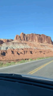
CAPITOL REEF REGION


where to stay
fruita campground
$20 a night
Part of Capitol Reef National Park
Restrooms have running water and flush toilets, but no showers. Potable water available too.
Within a gorgeous peach tree orchard within the red rock, spectacular landscape
BLM Land
Secret and FREE camping on land protected and maintained by The Bureau of Land Management. Set up camp wherever you feel inclined to!
E Hartnet Rd S, Torrey, UT 84775
A subtle dirt road can be seen off to the left, approximately 11.8 miles East of the Capitol Reef National Park Visitor Center, Torrey
Beautiful, wooded area right next to The Fremont River and just outside of the National Park area.
Driving through the park to this campsite is a stunning driving experience


adventures
HICKMAN BRIDGE TRAIL
1.8 miles / Moderate / Out-and-back trail
Fairly popular trail and very scenic
CASSIDY ARCH TRAIL
3.1 miles / Moderate / Out-and-back trail
Steep with lots of stairs and lots of views
GRAND WASH TRAIL
4.4 miles / Easy / Out-and-back trail
Flat trail through the canyon wash. In non-Summer months it does not offer much shade however
THE GOBLIN’S LAIR
2.4 miles / Easy / Out-and-back trail
Along with a super cool name, this stunning trail and area is hidden away on the park’s eastern boundary. The lair is in fact a slot canyon, the entrance of which has been sealed by rock fall. Depending on time of day, light may pour in through ceiling vents more than 100 feet above the chamber floor.
The trail begins at the observation point, and follows the Carmel Canyon loop before splitting off after 1/2 mile. Some moderate scrambling up scree slopes and over boulders is required. Caution is advised.


ARCHES region


where to stay
devil’s garden campground
$25 - $250 a night
Devils Garden Campground is located deep within the Arches National Park at an elevation of 5200 ft.. The campground is situated amongst the stunning sandstone arches and is only 18 miles north of the park's entrance.
Campfires allowed, pets allowed, toilets, tables, and potable water
Super popular national park but very spread out and home to iconic Delicate Arch
Really epic place but feels too congested after all the off the grid spots
gold bar group sites / blm camping
FREE but first-come-first-served
Epic spot for groups and right on The Colorado River
Sites have fire grates, picnic tables, vault toilets and sites A, B, and C have shade shelters. Site D does not have a shade shelter


adventures
MILL CREEK TRAIL + SWIMMING
7.5 miles / Moderate / Out-and-back
Beautiful waterfall and swimming hole with many a creek crossing on the trail
This can be a popular destination especially in the warmer months
delicate arch trail
3 miles / Moderate / Out-and-back
Steady incline and 610 ft of elevation climb
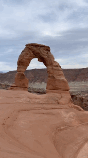
Without a doubt the most popular trail and destination within Arches National Park. The Delicate Arch is on the Utah license plate and is in no way a Secret Spot, however the trail and destination is just stunning and worth doing nonetheless. Doing this trail in the off-season and/or on a weekday is ideal for the least crowds
Be sure to check out some of the other amazing rock formations near the famous arch
corona and bowtie arch trail
2.3 miles / Easy / Out-and-back
This is another popular destination, however close-by access to The Colorado River makes it special and full of little nearby nooks and Secret Spots


MONUMENT VALLEY


where to stay
hilltop hilton
$65 - $80 a night (and so worth the “splurge”)
Unbelievable glamp-camp hybrid looking out onto the iconic and picturesque Monument Valley
Firepit with wood bundles for purchase upon reservation. Table, kitchen access, shower available, dogs welcomed, toilet, but no potable water and no wifi.
Fall asleep to the most epic view and starscape you could ever imagine
THE VIEW CAMPGROUND
$19.95 - $179.95 a night
They have lots of options; tent camping, RV spots, and cabins
This place has everything and is operated by the Navajo Nation
General store, tables, showers, wifi, potable water, pets allowed, toilets, and trash


adventures
monument valley scenic drive
Off-road/dirt-road-driving through and around the most epic and iconic landmarks in Monument Valley: Three Sisters, The Hub, Totem Pole, The Cube, Artists Point, City Butte, The Thumb, John Ford's Point Overlook
Stop a hike around wherever!
As of September 2020 this road is currently closed due to COVID-19
HONoRaBLE MENTIONS


DETOUR must do’s
The largest grove of Quaking Aspen trees (my favorite tree) and the largest one-root-system-organism in the whole world!!! Powerful vibes here
HOT SPRINGS
4.5 miles / Moderate / Out-and-back
Beautiful, multi-pooled mineral hot springs with a waterfall to boot!
0.2 mile / East / Out-and-back / $25 fee
Individual tubs as well as a big pool within the red rocks - very photographable
0.8 mile / Easy / Loop trail
Short excursion worth checking out. In the early morning or golden hour the sand dunes take on a pick hue from years of red rock erosion
18.7 miles / Hard / Out-and-back
Epic backpacking adventure (for experienced adventurers) to one of the most epic and visually stunning destinations on the planet
Backpacking Reflection Canyon is an intense, challenging hike that takes you through slot canyons, climbing up and down shifty sandstones and traversing rugged terrains and ravines.
Offline map is recommended since the trails are not marked well
GEAR reccomondations
KITCHEN GEAR
Sponge
Papertowels
Trashbags
Wipes (Lysol and baby)
Large Cooler
Cutting board
Cast Iron skillet
Covered pot
Instant Coffee
x2 Knives
Spatulas/Wood spoon/Tongs
Tin Foil
Salt, pepper, hot sauce, condiments, and other assorted spices
Cooking oil
Ziplock bags
Matches / long lighter
CAMP GEAR
Half Dome 2 Plus Tent + Footprint
15 - 30 deg Sleeping Bag (weather depending)
Good pillow - as long as I'm not backpacking, I usually bring one from my home bed
(optional)
Headlamp/flashlight
Water bottles/bladders/reservoirs
Pocket knife
PERSONAL GEAR
Pro Tip - Get your alcohol in advance since a lot of Utah is “dry” and don’t sell alcohol or only in certain places and times. Go for cans over glass if possible
Cards/Games
Hand sanitizer
Bug Spray / Centinela candle
Sunscreen
Cooler Backpack!!! My new fave essential for Summer
River/Water shoes (chaco's, teva's, and keen's are the best - and cutest ;))
Book/s
Toiletries
Medications
Toothbrush/toothpaste
Deodorant
Lip balm
Hiking backpack
Hip pack
Inflatable tubes/floaties (optional, yet necessary)
Yoga mat (optional)
Hair brush
Masks/Buffs